As a club we normally use the All Trails Map App. Here are the links to some of our favorite rides…..
** If you have a map you would like to share with the group please email to bchcaz@gmail.com We would be happy to include it here.
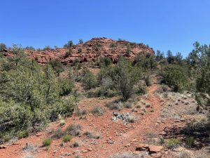
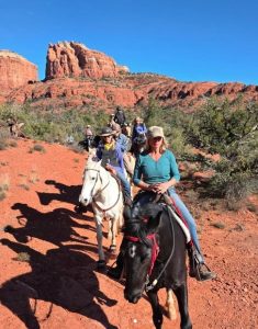
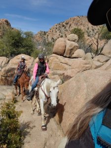
Turkey Creek, Sedona – Rated 3 – This is a 7 mile ride and takes almost 3 hours. Beautiful views, some rocks and hill to climb (you an do it). Don’t miss this one.
CLICK HERE to download map
Baldwin Loop, Sedona – Rate 4 because of some tricky manuevering thru the boulders and a few big jump ups. Stops by Oak Creek and meanders thru the green grassy area until it makes its way up the mountain for a fun, but a little challenging ride. 3.45 miles 1 1/2 hours. This is a busy trail for hikers.
CLICK HERE to download map
Stringfield #625 – Rated 2 This is an out and back ride. 7.8 miles About 2 1/2 hours. This trail has wonderful footing and nothing steep or hard – just some rolling hills and grassy meadows. This ride ends at a T-intersection (you’ll see the sign). Left continues on the #625 to Almosta Ranch Road Trailhead. Right takes you to 627 and a really big loop. Turn around there and head back to trailhead.
CLICK HERE to download map
Stringfield #1959 to #671 to #1959 Lollipop. Rated 2.5 9.5 miles About 3 hours Trail #1959 is called the Jim and Gayle (Higgs) Trail in honor of their work on creating this beautiful trail. You will head out about a mile on the dirt road until you see a gate by the water tank. Go thru the gate and the trail will veer off the the left. You will return opposite of where you entered the trail.
CLICK HERE to download map
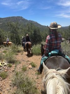
Peavine South (parking by the Humane Society) to Elizabeth to Bobbit to Iron King to Peavine and back. AKA The Storm Trail Rated 2 9.02 miles.
This is a beautiful trail with lots of boulders, meadow, some grass for a grazing stop. Warning! You will see plenty of bikes and hikers. Important for us to be NICE and courteous! Usually they will be nice and courteous also. This lollipop route took us just over 3 hours with a short potty stop. We chose this longer ride on the Peavine because it’s a bit prettier than coming from the North. It does add maybe 15 minutes to the ride, but I think it’s worth it. Plan on an hour ride from parking to the turnoff to the trail.
(by the way… we just rode up a bit on the Peavine to check out the entrance to another trail and then came back to the turn off so you’ll see a little tail on the north end) Also I marked a waypoint where the grassy spot was, but I forgot to resume for a little bit. Therefore you see a break in the trail, but just follow the trail and you won’t get lost. (good practice)
Also note when you get on the Iron King there is a metal bridge to ride on. Our horses weren’t quite sure about it since it was really noisy, but when a few brave ones did it the rest followed. If your horse won’t travel on it, you can go back the way you came and take the first trail on the left up to the Iron King. You can bypass the bridge.
Click here to download the map
TEST MAP AT ROXANNE’S HOUSE